Joel Daniels 2

I am currently working at NYU Polytechnic Institute as a Research Associate Professor. I received my PhD in 2010 from the University of Utah, during which time my dissertation research focused on automatic techniques for semi-regular, quadrilateral mesh processing and generation. More recently I completed a post-doctorate research appointment at the SCI Institute. Recently my research continues to focus on geometry processing challenges, including methods to re-use previously generated application specific mesh components and facilitate user-driven modeling tasks. Further, while at SCI, I have additionally applied mathematical concepts from my meshing research to facilitate scientific data exploration with dimensionality reduction, and explore uncertainty data visualization problems. These projects involve working directly with domain specific experts in collaborative environments.
About Me

jdaniels at poly dot edu
801 910 4141
70 S. Central Campus Drive
Room 3750
Salt Lake City, UT 84102
Contact Information

email:
phone:
address:
Interactive Quad Mesh Design
Despite the large number of (semi-)automated meshing algorithms developed, they are not being absorbed within commercial software packages. In this work, we are conducting interviews with artists and modelers to better understand their needs. The goal is to build the tools and underlying technologies to provide useful methodologies that can solve real world modeling problems.
Uncertainty Visualization
Uncertainty visualizations are becoming critical as the complexity of scientific data and the related visualizations continues to grow. Inspired by the original bifocal lenses invented by Benjamin Franklin, this work aims to build a system of interchangeable localized visualization lenses, to allow quick toggling between different uncertainty visualizations.
Dimensionality Reduction
Projection of a high dimensional data to a visual space is useful in many scientific visualization problems. Preservation of the distance measures in the high dimensional space within the plane enables visual analysis of clusters and relative similarities otherwise hidden in the high dimensional space. This work extends the vector field feature identification work from VIS 2010.
Provenance Rich Geometry Processing
Data provenance is a concept borrowed from the art community, in which historical information is maintained for a piece of work. Analogously we use VisTrails to transparently capture and track user interactions within professional modeling environments. The collected data is used to quantitatively analyze user tendencies and effort as well as provide a number of enhanced geometry processing tools.
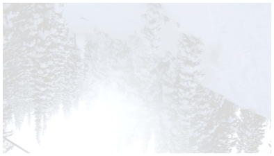
Open Wildland Fire Modeling
This project involves an interdisciplinary collaborative effort of physicists, simulation developers and visualization experts from multiple institutions. In addition to addressing the challenges of accurate wildfire simulations and generating interesting and useful visualizations, we are developing technologies to overcome difficulties related to managing remote simulation execution and online visualization control, as well as enabling collaborative research sessions and sharing data while working at geographic disparate locations.
Research Projects